
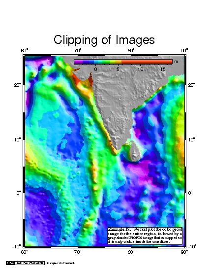
GMT is an open source collection of tools that allow users to manipulate (x,y) and (x,y,z) data sets (including filtering, trend fitting, gridding, projecting, etc.) and produce Encapsulated PostScript File (EPS) illustrations ranging from simple x-y plots through contour maps to artificially illuminated surfaces and 3-D perspective views in black and white, gray tone, hachure patterns, and 24-bit colour.
The software comes with a comprehensive collection of free GIS data, such as coast lines, rivers, political borders and coordinates of other geographic objects.
This is a command-line set of utilities. However, there are graphical user interfaces available (such as iGMT, Mirone,and SEATREE) from third party developers.
Key Features
- Over 80 tools for manipulating geographic and Cartesian data sets (including filtering, trend fitting, gridding, projecting, etc.) and producing PostScript illustrations ranging from simple x–y plots via contour maps to artificially illuminated surfaces and 3D perspective views.
- 40 more specialized and discipline-specific tools.
- Support for approximately 30 common map projections and transformations such as GSHHG coastlines, rivers, and political boundaries and optionally DCW country polygons.
- Support for linear, log10, and power scaling
Website: www.generic-mapping-tools.org
Support: Documentation
Developer: Paul Wessel, Walter H.F. Smith and contributors
License: GNU Lesser General Public License version 3 or any later version
GMT is written in C and C++. Learn C with our recommended free books and free tutorials. Learn C++ with our recommended free books and free tutorials.
Related Software
| GIS: Earth Science Software | |
|---|---|
| GRASS | Geographic Resources Analysis Support System |
| Quantum GIS | User friendly Geographic Information System |
| SAGA | System for Automated Geoscientific Analyses |
| GMT | Collection of tools that allow users to manipulate data sets |
| GeoServer | Server written in Java that allows users to share and edit geospatial data |
| OpenJUMP | Geographic Information System written in Java |
| gvSIG Desktop | Powerful, user-friendly Geographic Information System |
| PostGIS | Database extender for PostgreSQL object-relational database |
| WhiteboxTools | Advanced geospatial data analysis platform |
| MapServer | System for developing web-based GIS applications |
| uDig | Spatial data viewer/editor |
Read our verdict in the software roundup.
 Explore our carefully curated directory of recommended free and open source software, covering every major software category. Explore our carefully curated directory of recommended free and open source software, covering every major software category.The directory forms part of our extensive collection of articles for Linux enthusiasts. It includes hundreds of detailed reviews, together with free and open source alternatives to proprietary software from companies such as Google, Microsoft, Apple, Adobe, IBM, Cisco, Oracle, and Autodesk. LinuxLinks also covers interesting projects worth exploring, Linux-compatible hardware, free programming books and tutorials, and much more. Know a useful free and open source Linux application that we haven’t covered? Tell us about it using our submission form. |
Please read our Comment Policy before commenting.