
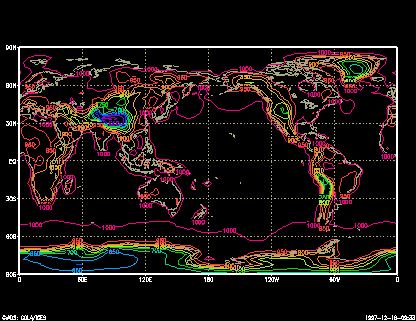
The Grid Analysis and Display System (GrADS) is an interactive desktop tool that is used for easy access, manipulation, and visualization of earth science data. The format of the data may be either binary, GRIB, NetCDF, or HDF-SDS (Scientific Data Sets).
GrADS has been implemented worldwide on a variety of operating systems.
GrADS uses a 4-Dimensional data environment: longitude, latitude, vertical level, and time. Data sets are placed within the 4-D space by use of a data descriptor file. GrADS interprets station data as well as gridded data, and the grids may be regular, non-linearly spaced, gaussian, or of variable resolution.
Key Features
- 5-Dimensional data environment: the four conventional dimensions (longitude, latitude, vertical level, and time) plus an optional 5th dimension for grids that is generally implemented but designed to be used for ensembles.
- Display data in a number of graphical techniques: Line and bar graphs, scatter plots, smoothed contours, shaded contours, vector, streamlines, wind vectors, grid boxes, shaded grid boxes, and station model plots.
- Reads GRIB (version 1 and 2), gridded binary, BUFR, GrADS station data, NetCDF (classic and NetCDF-4), HDF4-SDS, HDF5, and OPeNDAP (grids and station data).
- Writes binary, NetCDF (classic and NetCDF-4), GeoTIFF, KML.
- Draws and writes shapefiles.
- Animate images.
- Programmable interface (scripting language) that allows complex analysis and display applications. It is similar to REXX in implementation.
- Batch mode.
- GrADS scripting language allows for sophisticated analysis and display applications. Use scripts to display buttons and dropmenus as well as graphics, and then take action based on user point-and-clicks. GrADS can be run in batch mode, and the scripting language facilitates using GrADS to do long overnight batch jobs.
- GrADS Data Server (GDS) is a stable, secure data server that uses the OPeNDAP protocol to provide subsetting and analysis services across the internet.
Website: cola.gmu.edu/grads
Support:
Developer: Brian Doty and the Institute of Global Environment and Society (IGES)
License: GNU General Public License v2.0
GrADS is written in C. Learn C with our recommended free books and free tutorials.
Related Software
| Earth Science - Climate, weather and Earth-science data analysis | |
|---|---|
| GrADS | Grid Analysis and Display System |
| ncview | Quick and easy viewer for NetCDF files |
| MetPy | Tools for reading, analysing and visualising weather data |
| VAPOR | Interactive 3D visualisation for atmospheric and scientific data |
| NCO | Powerful utilities for manipulating and analysing netCDF data |
| Metview | Work with meteorological data, calculations and visualisations |
| wradlib | Process, analyse and visualise weather radar observations |
Read our verdict in the software roundup.
 Explore our carefully curated directory of recommended free and open source software, covering every major software category. Explore our carefully curated directory of recommended free and open source software, covering every major software category.The directory forms part of our extensive collection of articles for Linux enthusiasts. It includes hundreds of detailed reviews, together with free and open source alternatives to proprietary software from companies such as Google, Microsoft, Apple, Adobe, IBM, Cisco, Oracle, and Autodesk. LinuxLinks also covers interesting projects worth exploring, Linux-compatible hardware, free programming books and tutorials, and much more. Know a useful free and open source Linux application that we haven’t covered? Tell us about it using our submission form. |
Please read our Comment Policy before commenting.